Thursday, August 28, 2014

Mikros gets Navy contract for radar gear

Mikros Systems Corporation announced it has received a $5 million production contract from the U.S. Navy for its ADEPT radar maintenance equipment.

The electronic systems technology company, headquartered in Princeton, said in a news release that the Navy will purchase 54 ADEPT units over the next year, deploying them on Aegis destroyers and cruisers in support of the AN/SPY-1 radar on air defense and ballistic missile defense missions.

“We have been looking forward to this award for some time,” Mikros President Tom Meaney said in the release. “It’s a major corporate milestone and validates all of the hard work we’ve done on ADEPT development. We are delighted that the Navy has chosen to move forward with ADEPT production.”

Mikros said the contract increases its engineering backlog to an all-time high of approximately $8 million in work. It added that the systems will be assembled at Mikros’ Largo, Florida, facility.

Source

US Air Force Could Award Long-Range Radar Contract Next Week

Fire Control RadarThe U.S. Air Force is close to naming the winner of a contract to produce long-range, ground-based sensors for tracking hostile aircraft and missiles, Defense News reported Wednesday.

Aaron Mehta writes that Lockheed Martin (NYSE: LMT), Northrop Grumman (NYSE: NOC) and Raytheon (NYSE: RTN) are competing for the Air Force’s Three Dimensional Expeditionary Long-Range Radar development program.

The 3DELRR contract could be awarded next week and the selected contractor will work to build 35 air defense radars for the service, according to Defense News.

Mehta reports the branch plans a critical design review of the system by the end of the first quarter of 2015.

The Air Force also expects the technology to enter low-rate initial production in early fiscal 2018 and achieve initial operational capability by fiscal 2020.

3DELRRs will be built to replace the branch’s legacy AN/TPS-75 field radars, according to Mehta’s article.

Source

Cutting through the dust: Radar shows moon’s true face for first time

We’ve seen a serious series of super moons this summer and the show’s not over yet. Mark your calendars: the next one will light up on Tuesday, Sept. 9.

While it may seem sunny and clear up on a super moon, a steady rain of space dust and particles is zipping in and striking the moon day in and day out. Undetectable from Earth, these tiny travelers are moving fast.

“Most particles hit the ground at several kilometers per second or more,” explains Bruce Campbell, a geologist at the Smithsonian’s National Air and Space Museum. “A particle of dust moving at that speed will break a pretty good chunk off a rock.” This particle rain is the dominant erosive effect on the moon, part of an endless process of the rocks being broken down and the dust gradually building up.

This image shows the lunar impact crater known as Aristillus. The radar echoes reveal geologic features of the large debris field created by the force of the impact. The dark “halo” surrounding the crater is due to pulverized debris beyond the rugged, radar-bright rim deposits. The image also shows traces of lava-like features produced when lunar rock melted from the heat of the impact. The crater is approximately 34 miles in diameter and 2 miles deep. (Credit: Bruce Campbell, Smithsonian's National Air and Space Museum; Arecibo/NAIC; NRAO/AUI/NSF)

This radar image reveals how the lunar impact crater known as Aristillus looks beneath its cover of dust. The radar echoes reveal geologic features of the large debris field created by the force of the impact. The dark “halo” surrounding the crater is due to pulverized debris beyond the rugged, radar-bright rim deposits. The image also shows traces of lava-like features produced when lunar rock melted from the heat of the impact. The crater is approximately 34 miles in diameter and 2 miles deep. Click to enlarge. (Credit: Bruce Campbell, Smithsonian’s National Air and Space Museum; Arecibo/NAIC; NRAO/AUI/NSF)

Wednesday, August 27, 2014

Mongolia to reduce radar separation standards in September

Mongolia will reduce radar separation standards between aircraft from 90 to 30 km in September. The move follows a review of the Mongolian Civil Aviation Authority (MCAA) safety assessment requirements by New Zealand air navigation services provider Airways New Zealand.

Airways New Zealand has been helping MCAA to reduce aircraft separation distances following the installation in 2012 of radar sites across the region. Radar control has been gradually introduced, starting with a conservative 90 km separation between aircraft. Airways New Zealand has been working with MCAA to assess reducing radar separation standards to more closely align with the ICAO standard of five nautical miles (10 km). 

Tim Bradding, a former airways safety manager and current regional chief controller who has been working with MCAA, said: “Reducing aircraft separation requirements in a safe manner will allow the Mongolian CAA to more rapidly increase their air traffic flows, with economic benefits across the country and the region.”

Source

Improved US anti-radar missile hits its mark during test

The US Air Force and missile manufacturer Raytheon Co. successfully tested an upgraded anti-radar missile designed to more accurately take out enemy air defense early-warning systems.

An air force Lockheed Martin F-16 on 22 August fired an AGM-88 high-speed anti-radiation missile (HARM), which scored a direct hit on a specific radar emitter outside a zone of exclusion that included another decoy emitter, Raytheon announces.

The AGM-88 is used to find and destroy surface-to-air missile radars, early warning radars, and radar-directed air defence artillery systems to allow safe battlefield overflight of conflict zones by US and allied aircraft. The missiles identify and home in on the electronic transmissions emitted by radar installations. More than 4,000 HARMs have been fired in combat by the eight nations that include them in their munitions inventories.

"Raytheon's HCSM offers the warfighter enhanced capabilities at an affordable price, providing best value for suppression of enemy air defence weapon options," Mike Jarrett, vice president of Raytheon Air Warfare Systems, says in a statement announcing the test’s success.

Improvements to the missile in the recent test include a HARM control section modification (HCSM) that increases accuracy and precision, thereby reducing the risk of collateral damage, Raytheon says. GPS and an inertial measurement unit provide more accurate targeting and navigation data to the warhead after launch “to engage time-critical targets”, the company says.

The missiles is also specially designed to destroy modern surface-to-air missile installations and resist jamming and other counter-HARM systems.

“The HCSM used its new ... capability and successfully impacted the correct target,” Raytheon says. Yet more testing “is needed to determine if the HCSM is ready for deployment to the US Air Force.”

Raytheon produces HARM missiles under a 2012 contract with the air force and is currently under full-rate production.

Source

Tuesday, August 26, 2014

Radar: Your essential tool for safe flying

Radar had its birth in 1886 when Heinrich Hertz demonstrated that radio waves would reflect off of solid objects. 

As usual, war - specifically, the Second World War - spurred forward the development of Radio Detection and Ranging ('Radar' is just an acronym).  

Simply, radar works by sending a signal from a station in a certain direction. The signal will bounce back towards the station if it encounters a solid object. 

Over time we have been able to adjust the strength of our outgoing signals and the sensitivity of our receiver to enable modern day radar to tell us how solid the object is (rain, snow, ice or mountain) and in what direction the object is moving. All very helpful in weather forecasting. 

In aviation, radar is used to track aircraft movement both on ground and in the air. But, behind there’s also a radar behind the round front nose cone of most every aircraft. This helps pilots find other aircraft and, of course, avoid nasty weather and 'granite clouds.'

Great strides have been made in aviation radar in the past 20 years. Pilots can adjust the angle of their radar to inspect the height of clouds ahead and even abeam their planes. They can also look ahead up to several hundred kilometers, allowing themselves the option of avoiding developing weather altogether. 

Under development right now is Lidar. This uses lasers rather than radio waves to detect movement in molecules. 

When we can track movement on that small a scale we will then be able to see areas of turbulent air long before we fly into it.  

There are also developments aimed at making radar become predictive. In essence, it will model what a storm cloud will likely do by the time the aircraft is projected to be near it. That way, aviators can plan their storm avoidance long before they actually near threatening weather. 

Source

G band atmospheric radars: new frontiers in cloud physics

A. Battaglia1, C. D. Westbrook2, S. Kneifel3, P. Kollias3, N. Humpage1, U. Löhnert4, J. Tyynelä5, and G. W. Petty6

  • 1Department of Physics and Astronomy, University of Leicester, University Road, Leicester, UK
  • 2Department of Meteorology, University of Reading, Reading, UK
  • 3McGill University, Montreal, Canada
  • 4Institut für Geophysik und Meteorologie, University of Cologne, Cologne, Germany
  • 5Department of Physics, University of Helsinki, Helsinki, Finland
  • 6University of Wisconsin-Madison, Madison, Wisconsin, USA

Abstract. Clouds and associated precipitation are the largest source of uncertainty in current weather and future climate simulations. Observations of the microphysical, dynamical and radiative processes that act at cloud scales are needed to improve our understanding of clouds. The rapid expansion of ground-based super-sites and the availability of continuous profiling and scanning multi-frequency radar observations at 35 and 94 GHz have significantly improved our ability to probe the internal structure of clouds in high temporal-spatial resolution, and to retrieve quantitative cloud and precipitation properties. However, there are still gaps in our ability to probe clouds due to large uncertainties in the retrievals.

The present work discusses the potential of G band (frequency between 110 and 300 GHz) Doppler radars in combination with lower frequencies to further improve the retrievals of microphysical properties. Our results show that, thanks to a larger dynamic range in dual-wavelength reflectivity, dual-wavelength attenuation and dual-wavelength Doppler velocity (with respect to a Rayleigh reference), the inclusion of frequencies in the G band can significantly improve current profiling capabilities in three key areas: boundary layer clouds, cirrus and mid-level ice clouds, and precipitating snow.

Citation: Battaglia, A., Westbrook, C. D., Kneifel, S., Kollias, P., Humpage, N., Löhnert, U., Tyynelä, J., and Petty, G. W.: G band atmospheric radars: new frontiers in cloud physics, Atmos. Meas. Tech., 7, 1527-1546, doi:10.5194/amt-7-1527-2014, 2014.

Monday, August 25, 2014

80K6 - a vehicle-carried three-dimensional all-round-looking Ukrainian radar system

Ukrainian Mobile 3-D Air Surveillance radar 80K6

The 80K6 is a vehicle-carried three-dimensional all-round-looking radar system designed to detect and track airborne targets flying at low, medium and high altitudes. It can operate independently or as a part of regional or nation-wide computer-aided control systems. The technology was designed and developed by the State Research and Production Complex Iskra.

Ukrainian Mobile 3-D Air Surveillance radar 80K6M

If deployed with Air Defense Missile Force units, the 80K6 is used for target data generation for air defense missile weapons control systems. It can also be used by Air Force and air defense elements for air traffic control applications.

The 80K6 radar system offers performance capabilities as following:

  • The detection and tracking of air targets;
  • 3D location and cruising speed measurement of air targets in the presence of active/passive jamming or natural noise, or mix of these two;
  • Friend-or-foe air target identification;
  • Receiving flight-related information from friendly aircraft and transmitting the information to authorized users;
  • measuring the difference in flying target levels for accurate target designation;
  • determining azimuth and elevation bearings of active jamming dispensers;
  • feeding output data into autonomous imagers;
  • interoperation with command posts of local and higher nation-wide computerized control systems.

In terms of its technical characteristics and performance capabilities, the 80K6 radar system is as good as foreign-designed equivalents, while being at least fifty percent less expensive. The entire 80K radar system installation finds enough room onboard a single vehicle.

The accomplishment of very demanding performance capabilities was made possible by the employment of sophisticated state-of-the-art technical solutions, including:

  • low side lobe digital phased array providing enhanced performance capabilities involving target location in elevation and resistance to enemy active jamming attempts;
  • a klystron with a high gain factor which is used as transmitting device, providing the required level of average transmitting power while being not bulky and consuming little power;
  • Non-conventional design and configuration of the all-pass filter, providing an enhanced target discrimination performance capability and enabling target discrimination to be performed concurrently with the measurement of targets’ range rates;
  • improved primary information pre-processing algorithms enabling processing losses to be reduced to the minimum;
  • optimized target tracking algorithms enabling the multiple target tracking performance capability to be improved significantly;
  • equipping operator workstations with color displays, enabling operations to be performed in bright daylight.

See PDF booklet

Operating frequency range S-band (2700…2900 MHz)
Target detection  
           range 6 – 8 … 400 km
           in azimuth 360°
           elevation 0 ... 30 – 35°
           ceiling 400 km
Scanning interval 5; 10 sec
Detection range for targets with RCS equal to 3-5 m2, at P=0.8 and F=10-6,  
           at altitudes up to 100 m 40 km

           at altitudes up to 1,000 m

110 km
           at altitudes from 10 to 30 km 300 – 350 km
Clutter suppression coefficient > 50 dB
Number of targets tracked simultaneously 150-200

Time into and out of action

< 30 min

Source

Missile Defense | MDA Kill Vehicle Redesign, Target Radar Gain Traction on Hill

By Mike Gruss | Aug. 25, 2014

The Senate Appropriations defense subcommittee, chaired by Sen. Richard Durbin (above), a missile defense skeptic, noted that the new kill vehicle and the long-range target-discrimination radar are likely to cost more than $1 billion each to develop. Credit: DoD photo by Glenn Fawcett

The Senate Appropriations defense subcommittee, chaired by Sen. Richard Durbin (above), a missile defense skeptic, noted that the new kill vehicle and the long-range target-discrimination radar are likely to cost more than $1 billion each to develop. Credit: DoD photo by Glenn Fawcett

WASHINGTON — Two U.S. Missile Defense Agency initiatives designed to bolster the reliability and thus credibility of the primary U.S. territorial shield have won support from congressional appropriators, but lawmakers in both the House and Senate have made clear their intent to closely scrutinize the billion-dollar efforts.

The efforts in question are a redesigned kill vehicle for the Ground-based Midcourse Defense system interceptors, variants of which are currently deployed at Vandenberg Air Force Base, California, and Fort Greely, Alaska, and a long-range target-discrimination radar.

Tuesday, August 19, 2014

National Weather Service in Raleigh debuts faster Doppler radar

Meteorologists at the National Weather Service in Raleigh recently got an upgrade to their Doppler radar, giving them more data and quicker updates when the weather turns severe.

The upgrade, called SAILS, or Supplemental Adaptive Intra-Volume Low-Level Scan, allows the meteorologists to get radar images from the lowest part of the storm every 2 minutes instead of every 4.

“More frequent updates of what's going on near the ground gives us a better idea of what's about to hit the ground or impact the ground,” said NWS meteorologist Jonathan Blaes.

Blaes says the radar does more than just show where it’s raining. “It scans at multiple slices to get a 3D view of precipitation, thunderstorms and other phenomena,” he said.

Seeing what's happening inside a storm gives forecasters an idea of how dangerous it is and can tell them if a tornado is forming.

“The more observations you can get the closer to where people live, that's always helpful,” WRAL Chief Meteorologist Greg Fishel said.

WRAL’s DUALDoppler5000 radar scans the lowest layer of the atmosphere once every minute. That radar, along with the Weather Service's newly upgraded Doppler radar, gives forecasters a better chance of spotting dangerous storms. That helps them issue better warnings and save more lives.
“More data is always better, and that's what we're excited about,” Fishel said.

The National Weather Service radar upgrade is in place now, ready for the next severe weather season, which typically happens in the fall. Another upgrade is planned within the next year to allow even more frequent updates.

The National Weather Service is working on a new kind of radar system, already used in the military, called Phased Array Radar. It will scan in less than one minute and cost less to operate. It likely will be a decade before those radars are installed, Blaes said.

Source

Monday, August 18, 2014

Honeywell, Rockwell Collins roll out advanced cockpit radar

Vernon Bryant/Staff Photographer

Captain Bill Lusk of Southwest Airlines explains what the radar is showing to the media on a monitor during a Honeywell test flight that left out of Dallas Love Field Airport in Dallas on Wednesday, August 13, 2014. Honeywell developed new technology that helps pilots spot bad weather and then, by showing them the storm in 3-D, help them steer around it.

SOMEWHERE OVER SOUTH TEXAS — Smart pilots fly away from bad weather. But on this sweltering summer day, Markus Johnson and Joe Duval are flying straight toward thunderstorms swelling up over the Gulf of Mexico along the South Texas coast.

It’s not because they long to fly their 1952 Convair 540 through the rollercoaster of updrafts and downdrafts or to be pummeled by hail and rain. It’s to show off the latest generation of Honeywell International Inc.’s weather radar system, known as IntuVue.

They use the radar to skirt the right side of a good-size thunderstorm between Houston and Galveston, then the left side of another thunderstorm to the airplane’s right.

Inside the storms, the radar shows a lot of green (light rain) and yellow (medium rain) with a smidgen of red (heavy rain). But on the flight itself, the airplane glides through nearly smooth air as it flies between the two summer storms.

Of course, airlines and other aircraft operators have used radar for decades to help them locate and avoid storms. It’s a rare airplane that doesn’t have radar equipment installed in its nose and a display screen in the cockpit.

What Honeywell touts is that its new radar system displays a lot more information in greater detail, in three dimensions, and pilots don’t have to work nearly so hard to get it.

Greg Schauder, a Honeywell director of product marketing, said the two-dimensional radars usually require a pilot to manually change the radar scan if he wants to look higher up or lower down in a storm or in different directions. The radar collects information only where the pilot has asked it to scan.

Friday, August 15, 2014

Radar software may fix weather forecast issues caused by wind farms

The movement of wind turbine propellers can mimic weather when viewed by the Doppler radar used by Environment Canada to predict storms.

The movement of wind turbine propellers can mimic weather when viewed by the Doppler radar used by Environment Canada to predict storms. (Robert F. Bukaty/Associated Press)

Environment Canada is preparing to roll out new radar technology in order to combat wind farm clutter, which clouds weather forecasts, misleads meteorologists and can even block radar signals.

Jim Young, who works at the agency's national radar program, said new software will be incorporated into Canada's radar system this fall in an effort to address the "contamination" caused by wind turbines.

Tuesday, August 12, 2014

Environment Canada testing radar software to combat wind farm clutter

Wind turbines are shown in this file photo. (The Canadian Press/Dave Chidley)

Wind turbines are shown in this file photo. (The Canadian Press/Dave Chidley)

Clare Clancy, The Canadian Press Published Sunday, August 10, 2014 9:20AM EDT

TORONTO -- Environment Canada is preparing to roll out new radar technology in order to combat wind farm clutter, which clouds weather forecasts, misleads meteorologists and can even block radar signals.

Jim Young, who works at the agency's national radar program, said new software will be incorporated into Canada's radar system this fall in an effort to address the "contamination" caused by wind turbines.

"I certainly have very high hopes," he said, adding that Environment Canada has been concerned about wind farm clutter for years.

The agency uses Doppler radar to predict storms, but the movement of wind turbine propellers can mimic weather.

Friday, July 18, 2014

F-15E Radar Modernization Program (RMP)


Executive Summary

F-15E Radar Modernization Program (RMP) developmental flight testing began in January 2011. The RMP demonstrated incremental progress towards operational effectiveness, suitability, and mission capability during developmental test activities throughout FY11. IOT&E is scheduled to begin in June 2012.

The Air Force Operational Test and Evaluation Center (AFOTEC) conducted an Operational Assessment (OA) from January 5 through April 29, 2011, to assess RMP progress towards operational effectiveness, suitability, and mission capability in support of the program’s Milestone C decision.

During the OA period, RMP demonstrated functional equivalence to the legacy F-15E radar in some of the system’s air-to-air modes and made progress in meeting air-to-air detection and track capabilities under limited and highly scripted test conditions. However, short range air-to-air capabilities and air-to-ground capabilities were insufficiently mature to demonstrate functional equivalence during FY11 developmental flight test.

Two significant shortfalls were uncovered during FY11 developmental testing: unanticipated electromagnetic interference (EMI) between the radar and aircraft Ultra High Frequency (UHF) radio, and aircraft Environmental Control System (ECS) component failures and in-flight  cautions associated with RMP system integration on the aircraft. Resolution of these shortfalls is ongoing and should be completed prior to IOT&E.

Source and more...

F-15E takes first flight with new radar system

"The new radar system does everything faster, is extremely precise and requires less maintenance," Riley said. "It can designate air-to-air and air-to-ground simultaneously, allowing us to track enemy aircraft and identify ground targets at the same time."

  • Near-simultaneous interleaving of selected air-to-air and air-to-ground functions
  • Enhanced air-to-air and air-to-ground classified combat identification capabilities
  • Longer range air-to-air target detection and enhanced track capabilities
  • Longer range and higher resolution air-to-ground radar mapping
  • Improved ground moving target track capability

Replacing APG-70 mechanically scanned radar with an active electronically scanned array (AESA) system designated as the APG-82(V)1. The RMP replaces the F-15E's more than 20-year-old legacy radar.

The multi-mode AN/APG-70 is a 1980s derivative of the APG-63 that adds air-ground modes and maintainability improvements. Gate array technology adds air-ground modes, and improves air-air effectiveness. The APG-70 is employed on late model F-15C/D Eagles, all F-15E Strike Eagle aircraft, and on the Israeli F-15I and Saudi F15S Strike Eagle variants. Beyond the F-15, a variant of the APG-70 radar called the AN/APQ-180 adds a modified planar array, an upgraded signal processor, and several enhanced air-to-ground modes, for use on the USA’s AC-130U Specter gunship aircraft.

AN/APG-82. The F-15E RMP program’s fit-out would add a few refinements to the ‘v3,’ and receive a new designation: AN/APG-82v1. New Radio Frequency Tunable Filters (RFTF) will enable the aircraft’s radar and Electronic Warfare System to function at the same time, and an improved Environmental Cooling System (ECS) will improve liquid cooling capacity by 250%. Other back-end changes will include a new wideband radome, a new radio frequency tunable filter, updates to the F-15E’s core Operational Flight Program software and Electronic Warfare software, and wiring changes.

"The old radar system is hydraulic, has moving parts and requires three maintainers to perform repairs after every 30 flight hours," said Master Sgt. Jennifer Schildgen, 366th Fighter Wing avionics manager. "The new radar system is a beam scan, doesn't have any moving parts and is projected to only require one maintainer to perform repairs after more than 2,000 flight hours."

Source

Tuesday, July 8, 2014

Change in NWS Doppler Radar Scanning Strategy Will Provide Much Needed Data and Should Lead to Improved Warnings

A new software upgrade installed at the National Weather Service (NWS) Raleigh Doppler radar (KRAX) today, July 8th, is expected to have a significant impact in severe weather operations. Around two-thirds of all NWS Doppler radars have been upgraded as of today, with the rest likely occurring during the next few months. You can view the current build of each NWS radar here (radar’s with the upgrade have the RPG build listed as “14.1”). The software change will allow the WSR-88D radar to obtain the lowest level radar scan more frequently during severe weather events.

With this upgrade, a new feature called SAILS (Supplemental Adaptive Intra-Volume Low-Level Scan) will enable the radar to insert an additional 0.5 degree scan in the middle of a volume scan (see the illustration below for more details). Currently, the WSR-88D radar completes its lowest scan in 3 to 4.3 minutes (during severe weather), depending on the range of the storms from the radar. With SAILS, the radar can now perform this low-level scan every 1.9 to 2.5 minutes, obtaining a 0.5 degree scan almost twice as frequently as before and providing NWS meteorologists with the ability to observe rapidly changing weather phenomenon more frequently and issue more timely severe weather warnings.

A training presentation was provided to NWS Raleigh partners detailing some of the changes with the build, it can be accessed here.  The Warning Decision Training Branch (WDTB) has other training resources that are available online as well – RDA/RPG Build 14.0/RPG Build 14.1 training.

RAH.SAILS.infographic

Source

Thursday, June 5, 2014

Iran launches cutting-edge Ghadir radar system

Iran's Islamic Revolution Guards Corps (IRGC) has officially put into service a domestically developed long-range radar system capable of detecting stealth aircraft.

The advanced radar system, named Ghadir, was unveiled in a ceremony attended by military top brass, including Commander of Khatam al-Anbiya Air Defense Base Brigadier General Farzad Esmaeili on Monday.

The state-of-the art radar system uses three-dimensional (3-D) technology to detect airborne targets, including radar-evading aircraft, cruise and ballistic missiles, and satellites in low Earth orbits. The system was first unveiled during the Great Prophet 6 military drills in 2011. It was later mass produced by the IRGC's Aerospace Division and underwent several tests in recent months

The Phased Array radar can monitor targets within a radius of 1,100 kilometers at a maximum 300-km altitude.

In November 2013, Iranian navy unveiled an indigenous state-of-the-art array radar system, dubbed Asr (Age), which can detect long-distance targets.
In recent years, Iran has made major breakthroughs in its defense sector and attained self-sufficiency in producing important military equipment and systems.

Despite its great defense achievements, the Islamic Republic has repeatedly said its military might poses no threat to other countries, insisting that its defense doctrine is merely based on deterrence.

3D Phased Array early-warning radar Ghadir, Iran

Иранская РЛС дальнего обнаружения Ghadir

В Иране наконец-то представили трехкоординатную РЛС дальнего обнаружения Ghadir, о строительстве и испытаниях которой много говорили в последние годы. РЛС построена в шахрестане Гермсар остана Семнан, дальность обнаружения целей составляет до 1100 км и высота до 300 км.

Иранская РЛС дальнего обнаружения Ghadir

Wednesday, May 28, 2014

Казахстан собирается приобрести РЛС GM400

22 мая 2014 года на проходившей в столице Казахстана Астане оборонной выставке KADEX-2014 компания ThalesRaytheonSystems (TRS, совместное предприятие французской группы Thales и американской корпорации Raytheon) подписала меморандум о взаимопонимании о предстоящей поставке для Сил воздушной обороны Казахстана 20 наземных радиолокационных станций Ground Master 400 (GM400). В соответствии с меморандумом, сборка РЛС GM400 для Казахстана будет организована совместным предприятием Granit - Thales Electronics с участием Thales и казахстанского ТОО "СКТБ "Гранит" (Алма-Ата). РЛС получила в Казахстане обозначение "НУР". На выставке KADEX-2014 демонстрировался локализованный образец РЛС "НУР" (GM400), выполненный на базе автомобиля "КамАЗ".

РЛС "НУР" (ThalesRaytheonSystems Ground Master 400) в экспозиции выставки KADEX-2014. Астана, май 2014 года (с) ВКонтакте

Monday, April 28, 2014

Radar Research and Development Lab in Moscow

RRDL site – in Russian, content includes bibliography of their publications, review of modern radars and SAR, materials about multistatic radars/SAR, target detection, noise and passive radars…

Friday, April 25, 2014

The Python ART Radar Toolkit

The Python ARM Radar Toolkit, Py-ART, is a Python module containing a collection of weather radar algorithms and utilities. Py-ART is used by the Atmospheric Radiation Measurement (ARM) Climate Research Facility for working with data from a number of its precipitation and cloud radars, but has been designed so that it can be used by others in the radar and atmospheric communities to examine, processes, and analyze data from many types of weather radars.

What can Py-ART do?

Py-ART has the ability to ingest (read) from a number of common weather radar formats including Sigmet/IRIS, MDV, CF/Radial, UF, and NEXRAD Level II archive files. Radar data can be written to NetCDF files which conform to the CF/Radial convension.

Py-ART also contains routines which can produce common radar plots including PPIs and RHIs.

PPI Plot RHI Plot

Algorithms in the module are able to performs a number of corrections on the radar moment data in antenna coordinate including attenuation correction of the reflectivity, velocity dealiasing, and correction of the specific (Kdp) and differential (PhiDP) phases.

A sophisticated mapping routines is able to efficiently create uniform Cartesian grids of radar fields from one or more radars. Routines exist in Py-ART for plotting these grids as well as saving them to NetCDF files.

GitHub repository

Wednesday, April 23, 2014

ПВО Сирии

Башару Асаду нужно очень постараться, чтобы сорвать планы запада по «переформатированию» его страны

Уже больше года внимание всего мира приковано к ближневосточному региону, где в очередной раз решается судьба многих народов мусульманских стран. Новым объектом непосредственных государственных интересов США и их союзников по НАТО явилась Сирия с неугодным Западу режимом Башара Асада. Страна балансирует на грани настоящей гражданской войны с многочисленными людскими и материальными потерями. Гибнет мирное население, противоборствующие стороны, как водится, взаимно возлагают вину за это друг на друга. Отряды оппозиции, поддерживаемые Западом, приобретают организованную структуру, единое управление, получают поддержку вооружением, боеприпасами, продовольствием и т.п. с территории Турции, Ирака, Иордании, Ливана, так как сухопутные и воздушные границы Сирии практически открыты. Правительственные войска удерживают города и крупные населенные пункты, в то время как оппозиция контролирует около половины территории страны, включая почти всю сельскую местность.

Sunday, April 20, 2014

A new course in September 2014

Dr Jeanine Engelbrecht, Senior Researcher in the field of Synthetic Aperture Radar at the CSIR Meraka Institute in Rosebank, Cape Town, will be presenting in the University of Cape Town a course on Applications of Imaging Radar from 1 to 4 September 2014.

Dr Engelbrecht has over 10 years of remote sensing and spatial analysis experience. Her research and development focus has been on exploiting SAR technologies for a variety of applications including geological applications, hydrological applications and engineering geological aspects.

Her course will introduce participants to the principles of imaging radar with a particular focus on end-user applications, looking, for instance, at how signal processing of data collected from satellite-borne sensors can aid in the extraction of biophysical and geophysical parameters.

The backscattering characteristics of SAR signals will be identified, and students will learn how the information can be applied for 1) food security, 2) environmental applications, 3) disaster monitoring and relief, 4) defence peace safety and security and 6) human environments.

The course will consist of theory lectures as well as practical hands-on sessions in SAR image processing for a variety of applications.

More information can be found in this PDF: EEE 5012Z (2014) – Applications of Imaging Radar.

Source

Wednesday, April 16, 2014

Python-3 Ground Penetrating Radar

Wireless Monostatic Ground Penetrating Radar with one receiving-transmitting antenna Python-3.

4 frequency modules (25, 38, 50, 100 MHz) of the Python-3  - Wireless Monostatic Ground Penetrating Radar with one receiving-transmitting antenna4 frequency modules (25, 38, 50, 100 MHz) of the Python-3  - Wireless Monostatic Ground Penetrating Radar with one receiving-transmitting antenna

Features

  • FREQUENCES: 100 / 50 / 38 / 25 MHz
  • ANTENNA LENGTH: from 1 m to 4 m, depends on selected frequency
  • WEIGHT: from 10 kg to 20 kg, depends on selected frequency
  • TIME RANGE: from 1 to 1500 ns, step 1 ns
  • SCAN RATE: 28 scans per second
  • SAMPLES PER SCAN: 1024 samples per scan
  • RESOLUTION: 16 bit
  • FILTERS: Preset and Customized digital filters.
  • GAIN: 9 points digital gain function
  • DATA TRANSFER: through built-in Wi-Fi to PC.
  • POWER: Built-in battery 12 V, 9 A*h with battery life more than 7 h
Python-3 georadar is a portable digital subsurface sounding radar carried by a single operator, especially used for deep surveys (up to 50 meters* in favorable ground). The unit is designed for solving a long-range of geotechnical, geological, engineering and other tasks wherever nondestructive operational environmental monitoring is needed. In the sounding process, the operator is getting real-time information as a radiolocation profile (sometimes also referred to as radargram) on a display. At the same time, data are recorded on a hard disc for further use (processing, printout, interpretation, etc.). Examples of radiolocation profiles you can see below.

Thursday, April 10, 2014

Software Defined Radar Simulator

Github software project “The Software Defined Radar Simulator” is designed to provide in SystemC an accurate simulation of commonly-used SDR blocks. These models provide both run-time and compile-time adjustable parameters. Currently these blocks include:

  1. Phase Accumulator
  2. CORDIC down-converter
  3. CIC Filter (includes optional bit-pruning)
  4. FIR Filter
  5. Stimulus class to assist in test bench development
  6. Signal Generator classes to assist in testing.
  7. Recorder class to collect test output data.

Dependencies:

  1. SystemC version 2.3 software.
  2. Latest version of GCC.
  3. Latest version of Boost libraries ( www.boost.org ).
  4. Waf build tool.
  5. Yaml-cpp version 0.5.1 software.

Wednesday, April 9, 2014

Sense-And-Avoid Still Causing Triton Turbulence

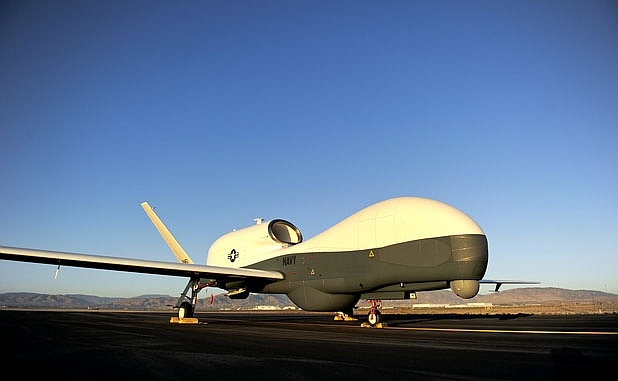
The U.S. Navy continues to assess its options to replace a sense-and-avoid radar that was to be used on the Northrop Grumman MQ-4C Triton unmanned aircraft, but failed to meet expectations.

Northrop Grumman MQ-4C Triton unmanned aircraft

Exelis was selected by Northrop to provide the radar, but the Navy put a stop-work on the contract one year ago and began an assessment of alternatives. No alternative is available off the shelf, says Sean Burke, Navy deputy program manager. The problem was miniaturizing the advanced, electronically scanned array (AESA) radar technology and providing sufficient cooling and power within the available weight and space. It was a “technical solution that turned out to be very challenging for us,” Burke said.

“We are really at the edge of the technology” in developing the system, said Mike Mackey, Northrop Grumman’s Triton program manager. He and Burke briefed the media on the program during the annual Sea-Air-Space 2014 show hosted by the Navy League.

Tuesday, April 8, 2014

Airbus Defence and Space receives radar contract extension in the Middle East

Airbus Defence and Space has been awarded a contract for the delivery of four of its Spexer 2000 security radars to further improve the surveillance of the borders of a major Middle Eastern country. The contract is an extension to an existing contract for the delivery of more than 40 Spexer 2000 radars, which have been operating successfully for almost two years now.

The Spexer 2000 security radar improves the surveillance of borders substantially. Photo: Airbus Defence and Space

Thomas Müller, head of the Business Line Electronics at Airbus Defence and Space, said: “Spexer 2000 is using state-of-the-art Active Electronically Scanning Array (AESA) technology, which provides a multi-tasking and multi-mode capability, and increases the detection and target assessment capability substantially. Due to this, Spexer 2000 can replace several conventional radars.”

Friday, April 4, 2014

Get ready for software-defined RADAR

With a big RF transmitter and enough fast computing power, you have the ability to do a lot of different things, as evidenced by a General Electric presentation on "software-defined radar" at the GPU conference this year.

At GTC 13 last year, GE gave a standing-room-only presentation about how it's using RDMA (Remote Direct Memory Access) to drive multi-GPU process performance to new heights. The firm was back this year to talk about new and innovative applications of GPU tech it has cooked up over the past year.

How it works: Simultaneous transmit/receive for a whole load of functions

How it works: Simultaneous transmit/receive for a whole load of functions

In its session, Dustin Franklin, GE GPU Applications Engineer guru, gives us an update on how it has been proceeding with RDMA and how it allows the electric company to build large scale, multi-node, products.

Thursday, April 3, 2014

Мировой рынок самолетов ДРЛОиУ в 2010-2017 гг.

ЦАМТО, 31 марта. В предстоящий четырехлетний период (2014-2017 гг.) объем экспортных продаж новых самолетов ДРЛОиУ составит 11 машин на сумму 4,376 млрд дол в случае выполнения графиков поставок по текущим контрактам, заявленным намерениям и проводимым тендерам.
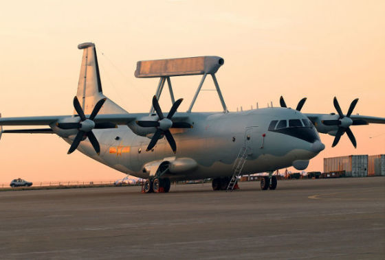
Самолет дальнего радиолокационного обнаружения и управления KJ-200 ВВС Китая

По оценке ЦАМТО, в прошедший 4-летний период (2010-2013 гг.) было поставлено на экспорт или произведено по лицензии не менее 30 новых самолетов на сумму 8,225 млрд дол.

Всего в 2010-2013 гг. было экспортировано 32 самолета ДРЛОиУ на сумму 8,3 млрд дол. При этом объем продаж новых самолетов в период 2010-2013 гг. составил 93,75% от общего количества или 99,1% от стоимости общемировых поставок.

В 2014-2017 гг. сокращение рынка в процентном выражении по сравнению с предыдущим 4-летним периодом составит 63,3% в количественном выражении и 46,8% – в стоимостном.

В 2010-2013 гг. средняя потребность в новых самолетах ДРЛОиУ на международном рынке составила почти 8 машин в год. В 2014-2017 гг. ежегодный спрос сократится до 3 ед.

По методике ЦАМТО, в категорию «новые» включены поставки новых самолетов ДРЛОиУ, а также поставки самолетов из состава ВС стран-экспортеров, модернизированных до уровня практически новых машин с продленным сроком эксплуатации, цена которых на момент поставки составляет более 50% от стоимости нового самолета того же типа на тот же период времени, но не менее 100 млн дол.

Первое место по периоду 2010-2017 гг. в рейтинге поставщиков новых самолетов ДРЛОиУ традиционно занимают США (17 машин на сумму 6,745 млрд дол). В 2010-2013 гг. на экспорт было поставлено 13 самолетов стоимостью 5,145 млрд дол, в 2014-2017 гг. поставки сократятся втрое и составят всего 4 новые машины на сумму 1,6 млрд дол (см. примечание).

Второе место по периоду 2010-2017 гг. занимает Швеция с комплексом ДРЛОиУ «Эриай», устанавливаемым на платформы по желанию заказчика (9 самолетов на сумму 2,111 млрд дол). В 2010-2013 гг. на экспорт было поставлено 8 самолетов стоимостью 1,444 млрд дол, на 2014-2017 гг. прогнозируется поставка 1 новой машины на сумму 667 млн дол.

Третье место по периоду 2010-2017 гг. занимает Израиль (7 машин на сумму 2,117 млрд дол). Поставки обеспечены комплексом ДРЛОиУ «Фалкон», устанавливаемым на платформы по желанию заказчика, и новейшей разработкой – компактной системой ДРЛОиУ CAEW на базе бизнес-лайнера G-550 «Гольфстрим». В 2010-2013 гг. на экспорт было поставлено 5 самолетов стоимостью 1,358 млрд дол, на период 2014-2017 гг. портфель заказов составляет 2 новые машины на сумму 758,6 млн дол.

Четвертое место с поставкой Пакистану в первом четырехлетнем периоде 4 самолетов ДРЛОиУ на базе комплекса KJ-200 стоимостью 278 млн дол занимает Китай.

По категории «тендер», результаты которых пока не подведены, в 2017 году возможна поставка 4 самолетов ДРЛОиУ на сумму около 1,35 млрд дол.

Примечание: в расчете не учтен контракт Катара с «Боингом» на поставку трех самолетов ДРЛОиУ общей стоимостью 6,6 млрд риалов (1,81 млрд дол), о подписании которого было объявлено 27 марта этого года.

Более подробный материал с табличными данными опубликован в журнале «Мировая торговля оружием» №2.

Права на данный материал принадлежат ЦАМТО
Материал был размещен правообладателем в открытом доступе.
Tuesday, April 1, 2014

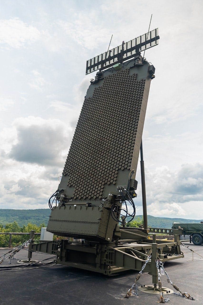
Подсолнух-Э

«Подсолнух-Э» - всепогодный береговой загоризонтный радар поверхностной волны (БЗГР) коротковолнового диапазона радиоволн

«Подсолнух-Э» - всепогодный береговой загоризонтный радар поверхностной волны (БЗГР) коротковолнового диапазона радиоволн, предназначенный для контроля надводной и воздушной обстановки в пределах 200-мильной экономической зоны прибрежного государства в составе береговых систем (ОАО НПК «Ниидар»). - Источник: rusarmy.com

Любопытной может стать сделка по продаже Бразилии загоризонтных РЛС «Подсолнух» – как заявил наш источник, бразильские военные оказались в восторге от демонстрации возможностей этого комплекса обнаруживать и отслеживать морские надводные и воздушные цели в сотнях км от берега в условиях реального времени. Российская армия имеет данные комплексы на вооружении на побережье Каспийского моря, и если сделка с Бразилией состоится, это станет первой поставкой данных РЛС за рубеж. - Деловая газета "Взгляд".

Monday, March 31, 2014

White Alice Communications System on Anvil Mt in Nome, AK

Thanks to DEW, which scattered 58 different early detection systems across northern Canada, it became necessary to develop a reliable way to communicate with each site. This was White Alice, a communications network that used tropospheric scatter and microwave relay to link the far north.

White Alice Communications System on Anvil Mt in Nome, AK

Wednesday, March 26, 2014

New Threats, New Technologies Push New USAF Radar Program

WASHINGTON — For years, the AN/TPS-75 has been the US Air Force’s “grab and go” radar system. Get it into an operational field, set it up, and it provides wide-range coverage of what is going on in the skies.

But like so much of the service’s technology, the TPS-75 needs revitalization. The threat environment has changed, and new technologies could render the radar “incapable of detecting some current and emerging threats,” according to service budget documents.
Enter the Three Dimensional Expeditionary Long Range Radar (3DELRR) program. The service plans to replace the TPS-75 with 3DELRR toward the end of the decade, assuming the budget holds.

In the Pentagon’s fiscal 2014 budget request, the service asked for $70.1 million in research, development, test and evaluation funds for the radar program, a figure Congress knocked down to $54.1 million in the National Defense Authorization Act.

For fiscal 2015, the Air Force has again sought an increase, this time to $88.8 million. That request rises to $98.2 million in fiscal 2016, and then drops to $68.6 million in fiscal 2017, $24.7 million in fiscal 2018 and $35.7 million in fiscal 2019.

A timeline included in the budget notes a goal to get 3DELRR out for initial deployment by fiscal 2020, which may explain why those figures drop over time; as the program gets closer to procurement, the need for research funding slows down. Low-rate initial production is scheduled to begin by early fiscal 2018.

Третий серийный А-50У для ВВС РФ

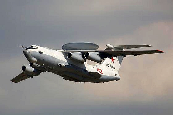
МОСКВА, 25 марта. (АРМС-ТАСС). ВВС России приняли сегодня на вооружение третий серийный модернизированный самолет дальнего радиолокационного обнаружения и управления (ДРЛОиУ) А-50У. Об этом сообщил ИТАР-ТАСС представитель Минобороны по ВВС полковник Игорь Климов.

Самолет ДРЛОиУ А-50. 100 лет ВВС России: Праздничное шоу в подмосковном Жуковском. Фото Александра Качкаева для "Ленты.ру"

"Самолет А-50У был передан сегодня на заводском аэродроме Таганрогского авиационного научно-технического комплекса им.Г.М.Бериева, входящего в Объединенную авиастроительную корпорацию. Самолет принят экипажем ВВС и совершит перелет из Таганрога к месту своего постоянного базировани", - рассказал он.

Представитель ВВС отметил, что кроме бортового номера эта машина получила собственное имя - "Сергей Атаянц", в честь Сергея Аванесовича Атаянца - авиаконструктора. непосредственно руководившего созданием авиационного комплекса А-50.

Самолет ДРЛОиУ А-50У предназначен для обнаружения воздушных и надводных целей, наведения экипажа истребителя на цели, передачи сигналов радиолокационной станции (обнаружения воздушных целей различных типов, в том числе, вертолетов, крылатых ракет, сверхзвуковых летательных аппаратов) на наземные пункты управления. Основа А-50У - мощный и современный радиолокационный комплекс "РМ". Самолет А-50 стоит в ряду лучших мировых аналогов по насыщенности сложным радиоэлектронным оборудованием, мощными системами электроснабжения.

Права на данный материал принадлежат АРМС-ТАСС
Материал был размещен правообладателем в открытом доступе.
Thursday, March 20, 2014

7th annual Military Radar Summit

Poland considers MEADS anti-missile radar

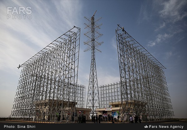
This surveillance radar for the MEADS missile defense system was designed and developed at the Lockheed Martin plant in Salina, NY. Costs were shared by NATO allies the United States, Germany and Italy. The surveillance radar can search 360-degrees for incoming missiles, planes and drones and be hauled around on the back of a truck. (Courtesy Lockheed Martin)

WASHINGTON -- A missile defense system the United States has no plans to deploy may find new life in Poland, where leaders Tuesday welcomed Vice President Joe Biden amid rising tensions over Russia's takeover of Crimea.

As Biden visited with President Bronislaw Komorowski in Warsaw, other Polish leaders met privately Tuesday with executives from MEADS International, the consortium developing the Medium Extended Air Defense System.

Poland selected MEADS International, and its main U.S. partner -- Lockheed Martin Corp. -- as one of four finalists for a contract worth up to $5 billion to modernize its air and missile defense systems.

If MEADS wins the competition, it would help boost business at Lockheed Martin in Salina, which developed the 360-degree search radar for the anti-missile system.
The other finalists for the Polish contract are a French consortium that includes Thales and MBDA, the Israeli government, and Massachusetts-based Raytheon, developer of the Patriot anti-missile system.

Wednesday, March 19, 2014

New USAF Radar Program

WASHINGTON — For years, the AN/TPS-75 has been the US Air Force’s “grab and go” radar system. Get it into an operational field, set it up, and it provides wide-range coverage of what is going on in the skies.

System Check: US Air Force personnel conduct an operational check of an AN/TPS-75 radar system at Balad Air Base, Iraq. (US Air Force)

But like so much of the service’s technology, the TPS-75 needs revitalization. The threat environment has changed, and new technologies could render the radar “incapable of detecting some current and emerging threats,” according to service budget documents.

Enter the Three Dimensional Expeditionary Long Range Radar (3DELRR) program. The service plans to replace the TPS-75 with 3DELRR toward the end of the decade, assuming the budget holds.

In the Pentagon’s fiscal 2014 budget request, the service asked for $70.1 million in research, development, test and evaluation funds for the radar program, a figure Congress knocked down to $54.1 million in the National Defense Authorization Act.

For fiscal 2015, the Air Force has again sought an increase, this time to $88.8 million. That request rises to $98.2 million in fiscal 2016, and then drops to $68.6 million in fiscal 2017, $24.7 million in fiscal 2018 and $35.7 million in fiscal 2019.

Lockheed Martin and Rowan University Partner on Radar Technology

Lockheed Martin and Rowan University are kicking off an innovative, strategic partnership to develop new technologies for a broad range of radar system applications in support of national defense. As threats to the United States become increasingly more complex, this next generation of radar technology is critical to protecting national assets and requires the dedication of an educated workforce.

Lockheed Martin and the University, which have collaborated on projects as part of the Rowan College of Engineering clinic program, are working together to expand their current partnership to conduct research and develop technology.

Research activities will be conducted at the South Jersey Technology Park at Rowan University in Mantua Township, N.J., about a mile from Rowan’s main campus in Glassboro. As research activities expand in scope, these activities will be accommodated at the planned second building at the Technology Park, which opened its first structure—the Samuel H. Jones Innovation Center—in 2008. The Innovation Center, at the juncture of Routes 55 and 322, is home to 16 sponsored College of Engineering research labs, among other offices.

Tuesday, March 18, 2014

Advances in Electronic Warfare Fly Under the Public’s Radar

Vital to U.S. strategic success in cybersecurity is the high-dollar investment in radar-jamming technology and other electronic warfare.

As the Pentagon moves beyond the relatively low-tech wars in the Middle East and turns its attention to future national security challenges, it has doubled down on sophisticated new radar-jamming devices that aim to render adversaries’ air defenses useless.

Although the U.S. faced limited resistance in the skies above Iraq and Afghanistan, that would not be the case in Asia, where the Obama administration plans to shift its diplomatic focus and strengthen its defense strategy in the coming decade.

Two F-16 Fighting Falcons pilots maintain their position as they wait for the rest of their four-ship formation to refuel during Red Flag-Alaska April 27, 2010. (U.S. Air Force photo/Capt. Shannon Collins) USAF

China and North Korea, for example, have quietly invested in advanced sophisticated radar systems, surface-to-air missile batteries and power-projection capabilities.

So when the Pentagon revealed its fiscal 2015 budget proposal two weeks ago, much of the attention was given to a boost in spending on drones and cybersecurity. Less heralded, but vital to U.S. strategic success, experts say, was the high-dollar investment in radar-jamming technology and other electronic warfare.

Much of this shadowy world is top secret, but the military’s goal is to have complete control over the range of wireless frequencies at the heart of all aspects of war: satellites, radio and radar.

Monday, March 17, 2014

International Radar Symposium IRS-2014 will be held in Gdansk, Poland -- June 16-18, 2014

Dear colleagues and members of the radar community,
According to complicated political situation in Ukraine, the Organising Committee of the International Radar Symposium IRS-2014 has made the final decision to relocate the IRS -2014 to Poland.

IRS-2014

Please follow all important changes on the IRS website   http://irs2014.lp.edu.ua/
NEW LOCATION:   Gdansk, Poland
NEW DATES:    June 16-18, 2014

The Symposium will start 2 days earlier than planned before!

NEW ABSTRACT/PAPER SUBMISSION DEADLINE:    March 30, 2014

Extended abstracts/draft papers can be uploaded online 
http://irs2014.dmcs.p.lodz.pl/irs2014/login/auth
Additional detailed information will be available within the next days.

The IRS-2014 attendees who need to apply for a visa to come to Poland, please contact the polish organisers via the emails:

Prof. Krzysztof Kulpa   kulpa@ise.pw.edu.pl
Anna Kurowska            a.kurowska@elka.pw.edu.pl

The Ukrainian participants who need a support to attend the IRS-2014, please contact Prof. Felix Yanovsky by email yanovsky@nau.edu.ua

We look forward to seeing you in a beautiful city of Gdansk in June.

Best regards,

Prof. Dr. Hermann Rohling, IRS-2014 Chairman
Dr. Anna Dzvonkovskaya, IRS-2014 Technical Committee Member

Sunday, March 16, 2014

Air Force Updates F-15 Fleet’s Radars, Sensors

The Air Force is in the early phases of a fleet-wide technological upgrade to the F-15 fighter jet to keep it in the air through 2035 and beyond, service officials said.

The upgrades include new radar, electronic warfare gear and computer systems for the F-15 C/D variants and the F-15E dual-role fighter, said Lt. Col. William Ottati, F-15 Program Element Monitor.

The F-15 C/D fighter planeThe F-15 C/D fighter planes, which first emerged in the mid-70s, are primarily engineered for air-to-air combat and air superiority missions. The F-15E strike eagle aircraft, first produced in the late 1980s, combine air-to-air attack technology with ground-strike mission ability.

Air Force leaders want to upgrade the fighters with the latest radars, electronics and sensors in order to keep them viable should the U.S. face a more advanced military than Iraq and Afghanistan.

Saturday, March 15, 2014

Iran is going to establish Space-Based Radar System

Iran has accomplished building its Sepehr (Sky) radar with a range of 2500km and hopes to deploy and launch the system in coming months, a senior commander announced on Sunday.

Space-based radar concept“We hope that we can launch a major part of the Sepehr space radar system by the end of the next (Iranian) year (March 21, 2014-March 20, 2015),” Commander of Khatam ol-Anbia Air Defense Base Brigadier General Farzad Esmayeeli told FNA.
“By launching the Sepehr space radar, we can inform our vessels of remote threats in time and monitor and detect threats before they are put into action, and start our defense in depth and away from our borders,” he added.

Esmayeeli underlined that Iranian engineers and technicians are making strenuous efforts to launch the Sepehr radar system which is seen as a hi-tech product.

In relevant remarks in February 2013, former Iranian Defense Minister Brigadier General Ahmad Vahidi said that Iran planned to develop different types of radar systems with satellite detecting capabilities.

Addressing the second conference on radar technology systems here in Tehran at the time, Vahidi said Iran has witnessed “a jump” in the field of radar designing and manufacturing.

“Today, we have many achievements in different fields. Radars covering ranges of 500km to 700km have been manufactured and production of radar systems with 1,000km to 3,000km of range is underway,” Vahidi explained.

He added that Iran is trying to develop radar systems to detect satellites, and said to do so, the radar systems are connected in phased arrangements to cover very long ranges and detect and track satellites.

Iranian officials have announced that the country has now reached self-sufficiency in producing radar systems in different frequencies and for various ranges.

Source

Thursday, March 13, 2014

New radar technology to free-up radio spectrum

New radar technology could help free up highly sought after radio spectrum currently used for air traffic surveillance.

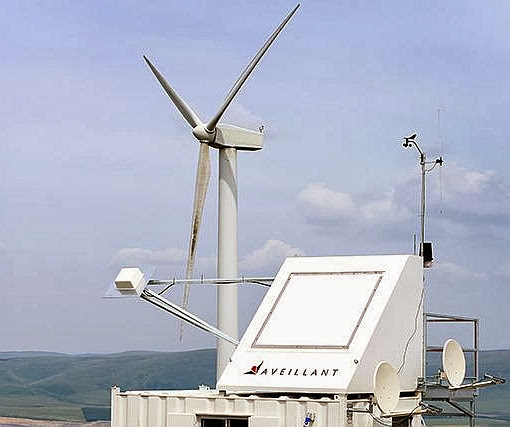
Aveillant's 3D Holographic Radar claims to mitigate the disruptive effect of wind farms on radar

The government has tasked the Civil Aviation Authority (CAA) with investigating options that would allow it to release bandwidth in the current air traffic radar spectrum allocation – in the ‘S Band’ between 2.7 and 2.9 GHz – to help meet its aspiration to free up 500 MHz of public spectrum by 2020.

In response, Cambridge technology firm Aveillant has been awarded a contract by the CAA to demonstrate the ability of its Holographic Radar technology to provide a spectrum-efficient alternative to S-band radar.

At present each radar typically has its own frequency assignment, but Aveillant hopes to demonstrate a surveillance system that can enable all air traffic control radars in the UK to operate through a single frequency assignment, separate from the ‘S Band’.

The firm’s radars use the L band frequency as opposed to the highly congested S band, used by current air traffic control radars and highly sought after by mobile phone operators.

Gordon Oswald, chief technology officer at Aveillant, said: “This is not a simple problem to solve, but based on our experience with Holographic Radar we’re confident that we are best placed to do so.

“Air traffic control radars cannot be simply shifted to another frequency, such as L band: this would then itself become too congested. At the same time, a much higher frequency is less suitable for long-range air traffic control radar due to atmospheric effects.

“This problem is ripe for a solution that changes the way air traffic radars occupy bandwidth. It’s going to be a demanding project to show how this solution will work – but one that we’re well equipped to handle.”

According to the firm, its 3D Holographic Radar is also proven to successfully mitigate the effect of wind farms on radar and has excelled in trials held by US and UK aviation stakeholders.

Source

Monday, March 10, 2014

WegenerNet: A Pioneering High-Resolution Network for Monitoring Weather and Climate

Gottfried Kirchengast, Thomas Kabas, Armin Leuprecht, Christoph Bichler, and Heimo Truhetz, 2014: WegenerNet: A Pioneering High-Resolution Network for Monitoring Weather and Climate. Bull. Amer. Meteor. Soc., 95, 227–242.
doi: http://dx.doi.org/10.1175/BAMS-D-11-00161.1

The Feldbach region in southeast Austria, characteristic for experiencing a rich variety of weather and climate patterns, has been selected as the focus area for a pioneering weather and climate observation network at very high resolution: The WegenerNet comprises 151 meteorological stations measuring temperature, precipitation, and other parameters, in a tightly spaced grid within an area of about 20 km × 15 km centered near the city of Feldbach (46.93°N, 15.90°E). With its stations about every 2 km2, each with 5-min time sampling, the network provides regular measurements since January 2007, after a pilot phase, until 2010, meanwhile in an operational manner. Quality-controlled station time series and gridded field data (spacing 200 m × 200 m) are available in near–real time (data latency less than 1–2 h) for visualization and download via a data portal (www.wegenernet.org; detailed information is available via www.wegcenter.at/wegenernet).

The WegenerNet region in southeast Austria

This paper introduces the WegenerNet from its design and setup via its processing system and data products to showing example results. The latter include extreme weather event examples, climate variability over the 5-yr period from 2007 to 2011, and an example of calibration support to coupled climate–hydrology modeling. The network is set to serve as a long-term monitoring and validation facility for weather and climate research and applications. Uses include validation of nonhydrostatic models operated at 1-km-scale resolution and of statistical downscaling techniques (in particular for precipitation), validation of weather radar and satellite data, study of orography–climate relationships, and many others.

Radarxense offers wide spectrum of radar modules


Radarxense-logo

Sunday, March 9, 2014

Cambridge radar for US homeland security market

A high technology radar from Blighter Surveillance Systems in Cambridge UK is being targeted at the US homeland security and commercial airport markets.

Blighter Surveillance Systems has teamed up with thermal imaging specialist Liteye Systems Inc – which worked on security at the London Olympics – to distribute its radars throughout North America.

Liteye has already sold combined Blighter radar and Aquila PTZ (pan, tilt, zoom) thermal imaging surveillance systems into a number of strategic sites in North America, including Centennial Airport in Colorado.

Blighter B402-SP E-scan Radar with W20S Antennas

The partners will promote a complete range of Blighter ground surveillance radars – including the new Blighter Revolution 360 radar, the long-range Blighter B400 series radars, the vehicle-mobile Blighter B303 radars and the man-portable Blighter B202 Mk 2 radars. The agreement will also include local manufacture and assembly of radars.

NASA could predict sinkholes with space radar

NASA announced Friday that it may have found a way to predict sinkholes up to a month before they occur. The warning would be provided by interferometric synthetic aperture radar (iSAR), which could be placed on satellites or planes to scan areas prone to sinkholes.

NASA may be able to use interferometric synthetic aperture radar (iSAR) to predict sinkholes up to a month before they occur. Sinkholes are depressions in the ground formed when layers of the earth's surface fall into underground caverns. Usually they form without warning. (Photo : Scott Ehardt | Wikimedia Commons)

iSAR scans the ground several times in several different wavelengths to put together interferograms, which can show small movements of the Earth such as the effect of flooding on riverbanks, the ripples of earthquakes and where the ground is sinking.

Sinkholes are depressions in the ground formed when layers of the earth's surface fall into underground caverns. Usually they form without warning.

Tuesday, March 4, 2014

Airbus Defence and Space naval radars to be showcased at DIMDEX 2014, booth No 435

At DIMDEX 2014, it's the first time that Airbus Defence and Space - a new division within the Airbus Group – is publicly present with all its four business lines at an exhibition in the Middle East region. The division has been formed by combining the business activities of Cassidian, Astrium and Airbus Military. At previous DIMDEX shows just Cassidian was present with its defence and security portfolio.

Airbus Defence and Space is Europe’s number one defence and space enterprise, the second largest space business worldwide and among the top ten global defence enterprises. It employs some 40,000 employees generating revenues of approximately €14 billion per year.

Within this new organisation Airbus Defence and Space is reinforcing its capabilities to service the customers better with a one-stop-shop offering an integrated portfolio based on one sales organisation under one strong brand, continue to build on a strong and reliable partnership with one known face to the customer and present the integrated and innovative product and services portfolio at competitive prices. The new Division started operating at executive level as of 1 January 2014.

Airbus Defence and Space is composed of four business lines: Military Aircraft; Space Systems; Communication, Intelligence & Security (CIS); and Electronics. It brings together a wide portfolio to continue to meet the complex needs of its customers across the world.

At DIMDEX 2014, it's the first time that Airbus Defence and Space - a new division within the Airbus Group – is publicly present with all its four business lines at an exhibition in the Middle East region. The division has been formed by combining the business activities of Cassidian, Astrium and Airbus Military. At previous DIMDEX shows just Cassidian was present with its defence and security portfolio.
Airbus Defence & Space TRS-4D AESA radar will be fitted onboard German Navy's future F125 frigates. Picture: Airbus Defence & Space

The business line Electronics will show a new generation of naval radars with unprecedented capabilities for the surveillance of sea areas and countering asymmetric threats:

TRS-4D is the innovative step from conventional radar into a "new dimension" of operational capability. It enables ships from patrol vessels to frigate size to exert the different detection tasks of a ship-borne medium range surveillance and target acquisition radar, in blue waters and also in complex littorals with high target densities. It performs faster, more accurate and against a wider scope of targets than conventional radars. TRS-4D provides navies and coast guards with the benefits of solid-state based AESA technology, which up to now has been available to highly expensive systems only. A non-rotating variant with four fixed array panels is under production for the new F125 frigates of the German Navy.

At DIMDEX 2014, it's the first time that Airbus Defence and Space - a new division within the Airbus Group – is publicly present with all its four business lines at an exhibition in the Middle East region. The division has been formed by combining the business activities of Cassidian, Astrium and Airbus Military. At previous DIMDEX shows just Cassidian was present with its defence and security portfolio.
Airbus Defence & Space TRSS (Tactical Radar for Surface Surveillance).
Picture: Airbus Defence & Space

Also on display is TRSS (= Tactical Radar for Surface Surveillance), a new naval X-Band radar optimized for the detection of extremely small objects and countering asymmetric threats. Based upon the latest AESA radar technology (AESA = Active Electronically Scanning Array), TRSS substantially increases the detection capabilities, and thus the protection level of navy ships and coast guard vessels. TRSS is able to detect and distinguish small objects precisely at close ranges, e.g. individual swimmers. These features give ship operators an optimal overview of the situation, e.g. against terrorist attacks, and enable ships to monitor movements on land.

Source

Civil Aviation Authority trials Cambridge radar

The UK’s Civil Aviation Authority (CAA) is using novel radar technology from Cambridge business, Aveillant.

Aveillant CTO, Gordon OswaldIt has awarded a contract to the company to demonstrate the ability of its Holographic RadarTM technology to provide a spectrum-efficient alternative to S-band primary air traffic surveillance radar.

The UK government aspires to release 500 MHz of public spectrum by 2020 and has tasked the CAA with investigating the viability of options to release bandwidth in the current air traffic radar spectrum allocation in the ‘S Band’ between 2.7 and 2.9 GHz.

The CAA is investigating two options: to change and reduce the spectrum occupied by existing aerodrome radars, and to exploit new, spectrum efficient solutions that have potential to provide additional benefits to aviation.