Wireless Monostatic Ground Penetrating Radar with one receiving-transmitting antenna Python-3.
 of the Python-3 - Wireless Monostatic Ground Penetrating Radar with one receiving-transmitting antenna")
Features
- FREQUENCES: 100 / 50 / 38 / 25 MHz
- ANTENNA LENGTH: from 1 m to 4 m, depends on selected frequency
- WEIGHT: from 10 kg to 20 kg, depends on selected frequency
- TIME RANGE: from 1 to 1500 ns, step 1 ns
- SCAN RATE: 28 scans per second
- SAMPLES PER SCAN: 1024 samples per scan
- RESOLUTION: 16 bit
- FILTERS: Preset and Customized digital filters.
- GAIN: 9 points digital gain function
- DATA TRANSFER: through built-in Wi-Fi to PC.
- POWER: Built-in battery 12 V, 9 A*h with battery life more than 7 h
Python-3 georadar is a portable digital subsurface sounding radar carried by a single operator, especially used for deep surveys (up to 50 meters* in favorable ground). The unit is designed for solving a long-range of geotechnical, geological, engineering and other tasks wherever nondestructive operational environmental monitoring is needed. In the sounding process, the operator is getting real-time information as a radiolocation profile (sometimes also referred to as radargram) on a display. At the same time, data are recorded on a hard disc for further use (processing, printout, interpretation, etc.). Examples of radiolocation profiles you can see below.
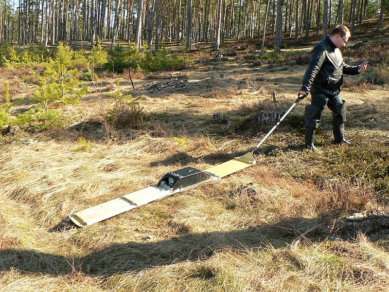
Georadar consists of central segment (100 MHz operating frequency) and 4 additional antenna plates to change operating frequencies to 50/38/25 MHz. Central segment includes control unit electronics, built-in 12 V 9 A*h battery, built-in Wi-Fi access point. Accessories set includes software, charger and tow-handle.

Georadar is made as dust/waterproof (IP67) and may be even immersed in water for a short time. Antennas have vinilplastic substrates with extremely high abrasion resistance. All georadar parameters are computer controlled,
Use of a specific antenna is determined by a sounding task. Higher sounding frequency means better resolution, but with more significant electromagnetic wave attenuation in the environment, resulting in lower sounding depth; and vice versa - lower frequency may lead to a larger penetration depth at the sacrifice of poorer resolution. Sounding depth is assumed that sounding is made in a soil whose relative dielectric permittivity is equal to 4 and specific attenuation is 1 to 2 dB/m. Depth of investigation is understood to be detection depth of a flat boundary with reflectance equal to 1. Note that these data are rather approximate and are strongly dependent on parameters of the environment sounded.
Comparing of 4 different frequencies (25, 38, 50, 100 MHz)
on the same place (Sandy dune near the Riga Bay, Lilaste, Latvia)

____________


No comments:
Post a Comment